Vishwawalking explained
 Ratings Explained
Vishwawalks
Day walks
Funky Places
Future walks
Food
Gear
Get Lost
Good reads
Links
Right to Ramble
Site map
Contact us
Sign just north of Rosebush Road, coming into Glen Ross.
Vishwawalking
Hastings Heritage Trail
Glen Ross to Bonarlaw
1) Glen Ross to Hoard's Road
Total: 4.1 kilometresRunning total (from Trenton): 26.5 kilometres
While the Hastings Heritage Trail officially starts at Glen Ross, I have included the Lower Trent Trail in the running total, as it is really all one trail for walkers.
The Hastings Heritage Trail continues the Lower Trent Trail, but now walkers have to beware of ATVs and snowmobiles. There is a parking lot on the west side of Glen Ross Road road just north of the canal. Walk west along the canal following the ruts the ATVs have made. The trail will soon turn right through some bushes and rise from the canal between a few houses to Rosebush Road.
 Click
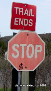
here or on any photo for more photos.A
sign here notes that the "trail ends." Another, announcing the Hastings
Heritage Trail, lists the kilometres at this point at 22.25. I'd guess
that the Eastern Ontario Trails Alliance, an ATV and snowmobile group
that oversees the Hastings Heritage Trail, is lusting to get the Lower
Trent Trail in into its fold — which would open the latter to
motorized machines.
Click
here or on any photo for more photos.A
sign here notes that the "trail ends." Another, announcing the Hastings
Heritage Trail, lists the kilometres at this point at 22.25. I'd guess
that the Eastern Ontario Trails Alliance, an ATV and snowmobile group
that oversees the Hastings Heritage Trail, is lusting to get the Lower
Trent Trail in into its fold — which would open the latter to
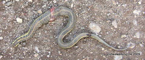
motorized machines.A dead snake, victim of an ATV
tire, lies in a track of the trail. This is the fate
of a number of snakes who like to sun themselves on the open trail.
The
difference between the Lower Trent Trail and this one is immediately
apparent. Tree branches and bushes have been mercilessly sliced away to
widen the track for vehicles. When you add the straightness of the
trail into the mix, it vastly reduces the attraction for walkers.of a number of snakes who like to sun themselves on the open trail.
The opening section of the trail passes through rolling farmland. As the trail approaches Carmel Road, a couple of farmhouses appear. An old cement silo and an old barn make the west side interesting. After Carmel Road, marshland (at least in the spring) and bush spread out on both sides before the land gives way to more fields.
The trail crosses Anson Road and shortly after meets the Trans Canada Trail. The TCT has been shared with the northern section of the Hastings Heritage we are about to encounter, but heads west here toward Campbellford. The trail from the east at this intersection comes from Madoc Junction and the Trail of Two Lakes. This intersection is just before Hoard's Road.
On the west side, just before the Trans Canada, a huge factory-style barn sits, with big fans set out along the walls. You can hear the fans whirring as you pass by.
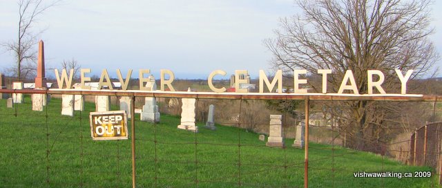
Weaver Cemetery, Hoard's Road
There are some interesting stones in this graveyard dating back to the mid 1800s.
Looking west down Hoard's Road, you can see the old Central cheese factory on the south side. It's no longer in operation.
Rating:
Easy. Walked:
April 26, 2009
(From the intersection of trails south of Hoard's Road to Bonarlaw, the following section is the northward chronicle of the identical southward description I have made in the Trans Canada Trail page.)
2) Hoard's Road (Anson) to Harold Road
Total: 8.7 kilometresRunning total: 35.2 kilometres
As I returned from this walk, on an early May evening, three vehicle, a car and two trucks, set off at a pretty good pace, heading north up the trail from Hoard's Road. The car led, bouncing up and down in the ruts. Earlier I had seen a muddy, dented unlicenced car with bashed-out back lights sitting behind a shed at 476 Hoard's Road. A quick check revealed that the car was gone, with new tracks in the trail showing where it had gone.
This busted car made plenty of noise, a bonus I suppose for any walker on the trail. A car with a muffler could take a walker by surprise. Nevertheless, I was glad I was off the trail as kind of activity is a recipe for disaster; in any collision with a walker, the latter will always lose. It's wise to remember that these sections of the trail are no different than country backroads for a few local drivers.
To smooth out excessive bumps or wet spots, parts of the trail from Anson have been covered with gravel made up of largish stones. It's just a nuisance for a walker, but I imagine it would be no fun for many bicyclers.
To Mount Pleasant Road and beyond, fields dominate. Human-made ditches run down both sides of much of the trail, with more ditches running across fields, draining water from the land. Notice too the old water troughs (at least I think that is what the rectangular open boxes are.)
Just after Mount Pleasant Road, you'll see an apiary, with a collection of hives set out in a clearing. On the
warm day in late April that I walked this section, the bees were already busily going about their business.
The trail starts to curve a bit as it approaches Barrett Road, then parallels Coutts, which is on the right (east), until the trail curves off to the east over Coutts and across King's Mills Road. When I walked this section, two ATVs had switched off the trail and onto Coutts, where they could spread out into both lanes and do a bit of racing. As usual, the machines were loud and obnoxious. Thankfully they were not on the trail when they roared past me.
Just north of King's Mills Road, as the trail curves, you leave the fields for a time and cedar trees, then some hardwood, line the trial. On a hot day, you'll find this a blessing. The trail then straightens out and crosses Hoard's Creek and then a little stream that's likely to be dry most of the year.
When you reach Wellman's Road (County Road 19), you'll notice Hoover road to your left (west), which you parallel for a while. About 700 metres north of Wellman, take a stroll across the rocks to Hoard's Creek. In the spring, all sorts of little rivulets empty into the creek. There's a particularly nice min-waterfall (by which I mean two feet high or less) hiding under a bush here in the spring. As you walk this section, with Hoard's creek on your right take a tour at appropriate places across the flat rocks to your left to check them out.
It's pretty straight going from Wellman's Road (County Road #19).
As you walk toward Harold Road, Hoard's Creek bubbles along merrily, just east of the trail. In the spring it has little rapids and nice "mini-gorges" (very small cuts into the land) that are well worth checking out. There are plenty of opportunities to walk across open rock to get to the creek.
Rating:
Easy Walked:
April 17, 29, May 2, 2009
3) Harold Road to Bonarlaw
Total: 6.6 kilometres
Running total: 41.8 kilometres
The trail is nasty straight for a while before it takes a welcome curve and Hoard's creek appears a couple of times. Hoards Creek is host to a large community of wildlife and a quiet sit by the riverbank is certainly rewarding. The creek flows eventually past King's Mills Conservation Area, through the hamlet of Hoards Station (where one of the province's few cattle sales barns still operates) and empties into the Trent River. Like nearby Rawdon Creek, it is one of a complex of streams and marshland that feed the Trent River.
Watch out for the underpass just south of the McConnell Road extension. It was totally dry and seemed made more for human passage than for water. When I did my return walk (southward) on this section, I had time to stop at this section for a while. I passed under the tunnel to the riverbank and watched a beaver cruise about. He thrashed his tail a couple of times, but eventually climbed out of the water on the opposite bank and began loudly chomping at a bit of wood. I walked back under the tunnel and followed a trail that ran up the hill and off to the right.
This is a great area, with trails running here and there in the bush. Some sections were a bit wet, while others rose up to mini-meadows. I came upon a hunt camp at one point, made partly from an old trailer. It was in serious disrepair. At another point a pheasant strutted across a grassy spot.
This side trip was definitely a highlight of the day's walk. I'm guessing that there are many more fine trails on the west side.
At about 1.6 kilometres north of Harold Road, McConnell Road comes in from the east. On my map it shows the road as coming as far as the trail, but it actually ends 60 metres before that and a rough gravel trail runs to the trail. On the west side, the a dirt track continues down to the edge of Hoards Creek. Across the creek, I could see the path continuing. Definitely a route to explore when the water is lower, but the spring run-off water looked a little daunting.
At about one kilometre south of Spring Brook Road a murder of ATVs came toward me on the trail, so I decide to head to the west and follow what looked like an old horse trail through the woods and around some wet spots. It eventually petered out and I did a short bit of bushwhacking until I met a fence that led me back to the trail. All along this little side trail where choices I could have made and I happily buried myself in the woods for a while — a welcome relief from the straightness and flatness of the trail. A great example of the joys of "getting lost."
As I rejoined the trail, more ATVs descended and I spent some time along the edges of the trail wishing I could spend more time investigating paths that disappeared into the bush. There are all sorts of tantalizing trails heading off on each side. The red circle indicating private land is also prevalent.
Shortly before Spring Brook Road, the trail cuts into the hillside and for a brief while, you don't get to see much of the countryside.
As you come up to Spring Brook Road, you'll see a little parking lot beside the trail. It features a dilapidated outhouse. Don't use it; it's disgusting. Once over the road, you'll see houses to your right and a farm on the left.
After a bit of a curve, this next section is pretty straight. Despite this, there are some great marsh sections and in the spring, the peepers were out in force along with ducks and other feathered creatures. We watched a couple of garter snakes sunning themselves beside the trail and wondered about the fate of several furry caterpillars running along the trail's tracks.
The trail bed is generally comfortable walking, although, it can be a bit hard on the feet stuck in a tire track; switch sides periodically. The trail, as usual, is too straight for comfort, but rides high through farmland, bush and a lot of marsh.
On the sunny spring Sunday afternoon we did this bit (I walked this section with my wife, Carol), there were numerous ATVs, usually in groups of two or three, heading in both directions. All were travelling at reasonable speeds. A motorcycle also passed us on this section.
Partway along this section, we saw Holstein cattle off to our left. In the spring, the cattle wade through marshland, munching on the surrounding grass, and drinking and defecating in the water. Not a pretty sight.
After crossing St Mark's Road (or St. Mark's, depending upon what literature or sign you're reading) it's a short jaunt to the junction of the Trans Canada and a trail that heads off to near Havelock. A few houses line St. Mark's Road.
The Hastings Heritage Trail northward at this point on April 5 was a wide south-flowing stream, so it was an appropriate spot to turn around for the day. A heavy rain a couple of days before made walking this section along the built-up sides of the trail difficult, although we saw a couple doing just that, as well as a couple of ATVs ploughing northward through the water.
Rating:
Side trails south of
Spring Brook Road:
Easy. Walked:
April 5, 10, 2009
Click here or on any photo for more photos.On to the next section of the trail (Bonarlaw, past Marmora to Bannockburn)
Back to the main Hastings Heritage Trail page
Home | Contact Us | Site Map
Page
created: March 12, 2009
Updated: April 25, 2009
Updated: April 25, 2009