About Us
Vishwawalking explained
 Ratings Explained
Vishwawalks
Parks, etc.
Funky Places
Future walks
Food
Gear and Health
Get Lost
Good reads
Links
Plants - Animals
Right to Ramble
Site map
Contact us
Vishwawalking
Appalachian TrailNeel Gap (mile 31.7)
to
Dick's Creek Gap (mile 69.6)
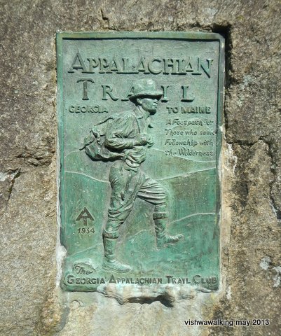
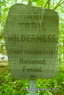
This sign, identical to the one on Springer Mountain, is somewherw on the trail
south of Tray Mountain.
Day 5. May 28, 2013
Neel Gap (mile 31.7 to Low Gap Shelter (43.2). 11.5 miles
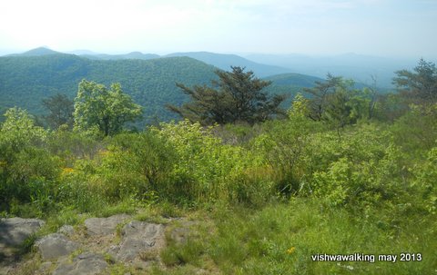 I got away from Neel Gap at around 8 a.m after a good breakfast
courtesy of Pirate at the Mountain Crossings bunkhouse. At the outset,
the trail runs through Ravens Cliff Wilderness, part of the
Chatahoochee National Forest.
I got away from Neel Gap at around 8 a.m after a good breakfast
courtesy of Pirate at the Mountain Crossings bunkhouse. At the outset,
the trail runs through Ravens Cliff Wilderness, part of the
Chatahoochee National Forest.There are some great views along this stretch, including Levelland Mountain and Wolf Laurel Top.
I stopped for a breather at mile 36.7 at Cowrock Mountain (left).
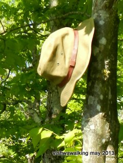
Above: View of the Blue Ridge Mountains east from Cowrock Mountain. Left: a fine hat left hanging from a tree branch on Cowrock Mountain. It was too small for me. Too bad. March 28, 2013
A marathon runner, Arthur, passed me in short order and disappeared up the trail.
At Cowrock, I spoke to a man walking solo. He was looking flushed. He said he came from Colorado. After pleasantries, he sat down to enjoy the view.
He was "taking it slowly," but wanted to get as many miles in as he could. He said he had unlimited time. A little further down the trail I found that he had decided to call it quits.
Then Walkabout Dave caught up with me and we had lunch by the highway at Tesnatee Gap (mile 37.7). This is where the Mark Trail Wilderness (also part of the Chatahoochee National Forest) begins. I remember the Mark Trail cartoon character from my childhood days (see the Wikipedia article for more detail.). Creator Jack Elrod still puts out the syndicated strip, although some say the artwork and storylines have slipped from
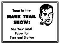 their glory days.
 After lunch, Walkabout took off for Low Gap Shelter five miles off. I
followed, finding it a long five miles, with Wildcat Mountain, Poor Mountain, and Sheep Rock Top following in short order.
After lunch, Walkabout took off for Low Gap Shelter five miles off. I
followed, finding it a long five miles, with Wildcat Mountain, Poor Mountain, and Sheep Rock Top following in short order.Mark Trail, a cartoon character
from the 1940s. He's still being
syndicated. In the early '80s,
he lost his characteristic pipe.
Photo: from wikipedia
There are some great views, from Wildcat Mountain particularly.
I reached Low Gap Shelter (mile 43.2) in the early evening and no one was there. Walkabout soon appeared; I had passed him while he was off getting water.
The trail enters the Mark Trail Wilderness
near Tesnatee Gap; Trail is a fictional cartoon
character created in the forties
Soon two young guys came in and camped nearby, along with a larger group of religious folks. The two guys had seen a bear just moments before. Mission Man soon arrived too; he had been travelling with a companion who gave it up at Neel Gap. Then Madison arrived. She too had just seen a bear.
As we chatted, we quite naturally started planning how far we would walk the next day. Here started a fine relationship between four of us: Walkabout, Mission Man, Madison and myself. At that time I was calling myself Sneaky Pete, but this would gravitate to Poncho Pete for reasons that will become clear later.
The religious group asked us to join them at their campsite for a Bible study. I politely declined on behalf of our group.
Madison was thru-hiking to Maine, where she lives. Mission Man was from Kentucky; he hoped to make it to Damascus as did Walkabout. That meant I would be the first to leave the group, in the Smokies.
Low Gap has cables, so after supper it was an easy matter to sling our food up. Water is about 30 yards (27.5 metres) away.
Day 6. May 29
Low Gap Shelter (mile 43.2) to Tray Mountain Shelter (mile 58.6) 15.4 miles
This was a long day with some pretty brutal mountains to climb. It's a slow climb with few downward breaks until Blue Mountain—when the grade gets sharply steeper. There's a shelter before the peak of the mountain.
From Blue Mountain it's a steep drop (1,076 feet over 1.5 miles) into Unicoi Gap (mile 52.9). From here you can get a shuttle into Helen (nine miles to the east) or to Hiawassee (12 miles west). We decided to slog on.
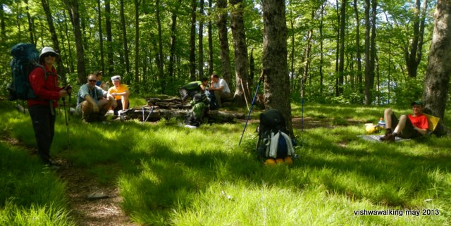
Resting near rocky Mountain, one of the most arduous climbs so far. Left, Madison, Walkabout (sitting), two
hikers in the background, Mission Man, far right.
Rocky Mountain! This one will
really test you. All that drop from Blue Mountain has to be regained;
it's a 1,068 feet elevation over 1.4 miles from Unicoi Gap to the peak
of Rocky Mountain, then an 884 drop over 1.3 miles —and then you get
to tackle Tray Mountain!
Tray Mountain: a 1,066-foot elevation over 1.8 miles. The Tray Mountain Shelter is 0.5 miles from the peak, but it seems a lot longer after such an up-and-down day. PUDS as some call them — pointless ups and downs.
The numbers above might seem boring to the uninitiated, but believe me, after a day like this, every hiker becomes accutely aware of elevation.
There are cables at the Tray Mountain Shelter and water is about 0.1 miles away.
Day 7. May 30
Tray Mountain Shelter (mile 58.6) to Deep Gap Shelter (mile 66). 7.4 miles
After yesterday's intense walk, this was a relief. The morning started of with a generally downward hike and the only serious climb was Kelly Knob. We reached Deep Gap at about 6 p.m.
Our foursome is bonding well. Whether it's a good laugh, talking politics or working collectively to do the daily camp tasks, having hiking companions is a true delight. Living so closely together speeds up the friendship process and I felt truly blessed. I really hope I'll see my new friends long after we're off the trail.
Eating rituals: everyone has a routine. Early on, I abandoned my breakfast porridge, although it is a treat after a cool night. I often passed on morning tea as well, settling for some granola or the like. During the day, I ate energy bars (homemade as long as they lasted), jerky (again mostly homemade), peanut butter on pita bread, mixed nuts and even a Snickers bar or two.
I liked flavoured drinks, which really amounted to not much more than glorifiied Kool-Aid. I also carried "Emergen-C" (which contains 1,000 grams of vitamin C), but found it took a lot of powder to decently flavour a litre of water, and even then the flavour was not very exciting. However, they do purport to carry lots of essential nutruients. Check out this review of Emergen-C.
I also inherited some packages of crystal light, which are not much more than Kool-Aid, and a Kraft product to boot. My guilty secret: I liked them.
For supper, I usually resorted to a packaged ready-made meal after my home-made dehydrated food was gone. I use MSR's international version of their "Whisperlite" stove. It burns white gas (aka Coleman fuel) and is a single-burner. It's hard to control the heat levels and it burns very hot, so i have various methods to keep my meals from burning; the main one is paying attention. I also have a home-made piece of perforated metal that i sometimes use to separate the pot from the burner a bit. By the way, the Whisperlites work best on the smallest fuel container; on the Appalachian, with the opportunity to refuel every four to six days, one canister is all that is needed.
If I need to cook two separate pots of something, such as rice or macaroni and a sauce, I cook the rice and place it in my hot-pot insulator (unfortunately my brand is no longer available), allowing it to further cook away from the stove. The insulator also serves as a bag for all my cookware and my stove. My only pots when travelling solo are Snow Peak's two-piece mini solo cookset. I carry one of those small "squishy" bowls for any extra stuff I might need for a meal.
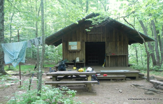
Deep Gap Shelter. There's a loft in this shelter, which made it convenient (although I seldom used the shelters).
Many shelters also have covered "porches" (although this one doesn't) containing a picnic table, which is convenient when it's raining. There is an outhouse here. No cables.
We've been lucky so far: no rain
to speak of. I was so tired after hiking most days' that I did a lousy
or non-existant job of chronicling most days in my journal. In fact, my
most extensive notes were made on the bus to Atlanta, when I had lots
of time.
Day 8. May 31
Deep Gap Shelter (mile 66) to Dick's Creek Gap and Hiawassee. 3.6 miles
We planned this short day to allow us a decent day relaxing in Hiawassee. A "zero day would have involved hanging around a shelter for two days or paying for two days at a motel.
 We
phoned for a shuttle from Powell Mountain (just over a couple of miles
from Dick's Creek Gap) and got into Hiawassee sometime after noon.
Just as at Neel Gap, a shower and the laundromat seemed like pure luxury. At Neel Gap, as I waited for my turn in the shower, a hiker emerged from the washroom looking squeaky clean. "Best shower ever," he chortled.
I know exactly what he meant.
Day 8. May 31
Deep Gap Shelter (mile 66) to Dick's Creek Gap and Hiawassee. 3.6 miles
We planned this short day to allow us a decent day relaxing in Hiawassee. A "zero day would have involved hanging around a shelter for two days or paying for two days at a motel.
 We
phoned for a shuttle from Powell Mountain (just over a couple of miles
from Dick's Creek Gap) and got into Hiawassee sometime after noon.
We
phoned for a shuttle from Powell Mountain (just over a couple of miles
from Dick's Creek Gap) and got into Hiawassee sometime after noon.Just as at Neel Gap, a shower and the laundromat seemed like pure luxury. At Neel Gap, as I waited for my turn in the shower, a hiker emerged from the washroom looking squeaky clean. "Best shower ever," he chortled.
I know exactly what he meant.
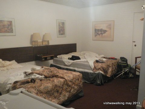
A $40 room at the Budget Inn (the hiker rate). Pure luxury. Divide the cost with another
hiker and it's a deal.
As I only had one shirt and one pair of pants (complete wardrobe: the above, a hat, two pairs of socks, two pairs of undersocks and two pairs of underwear), I sat in my poncho at the laundromat waiting for the joy of wearing clean clothes. Then it was off to the shower.
Cleaned up and ready for a meal, we then met Mission Man's parents. They had driven from Kentucky to visit him. We all went out for a buffet meal at Daniel's Steakhouse (see Tripadvisor reviews here). The steakhouse is suffused in Christian imagery, something one sees a lot in these parts. Mission Man's folks picked up the tab for all of us—this is true trail magic.
("Trail magic" is any act of kindness by a non-hiker. It could be fruit, beer or other luxuries handed out or left by the trail, usually at a road crossing, or a shuttle around the area on a non-walk day, or in our case a full restaurant meal.)
I know the hospitality of people from the American south is a bit of a cliché, but I've got to say that I met with many helpful and friendly people on my hike. It really was a major highlight of the trip.
Hike rating:


 Difficulty: Very strenuous
Back to main Appalachian Trail page
Back to previous section: Stover Creek Shelter to Neel Gap
Forward to next section: 3. Dick's Creek Gap to Rock Gap Shelter (mile 106) — still working on it.
Home | Contact Us | Site Map
Page
created: August 2, 2013
Updated: March 17, 2021
Updated: March 17, 2021