About Us
Vishwawalking explained
 Ratings Explained
Vishwawalks
Day walks
Funky Places
Future walks
Food
Gear
Get Lost
Good reads
Links
Plants - Animals
Right to Ramble
Site map
Contact us
Vishwawalking
Vanderwater maps
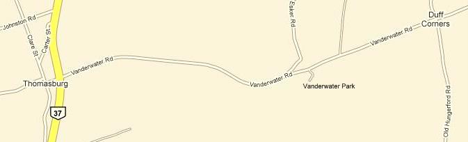
Getting to the park:Starting at Highway #401 and #37 out of Belleville, Ontario, head 24 kilometres north on #37 to Thomasburg. Turn right on Vanderwater Road just before the gas station. In 2.6 kilometres, just after you cross the Moira River, turn right into the parking lot. The map below shows the 2.6 kilometre road to Vanderwater Park from Highway #37 and Thomasburg. (Strangely, it does not note the Moira River).
Below is a Google map you can click on to enlarge the trail section. I have outlined all the official and some unofficial trails.
The trails are pretty self-explanatory. Blue Green and Red correspond to the trails of the same name. The Grey trail is the Nature Trail, the thicker grey trail is the rather obscure trail I describe along with the Nature Trail. The Yellow trail is the trail to Moneymore Road. The Magenta trail leads to the Moira River at the back of the park.
View Larger
Map
Home | Contact Us | Site Map
Page created: March 16, 2009
Updated: April 19, 2013
Updated: April 19, 2013