About Us
Vishwawalking explained
 Ratings Explained
Vishwawalks
Day walks
Funky Places
Future walks
Food
Gear
Get Lost
Good reads
Links
Right to Ramble
Site map
Contact us
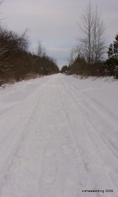
Murray Canal. Straight and...

Straight again! (Right click, and select "view image" for larger photo.)
January 5, 2009
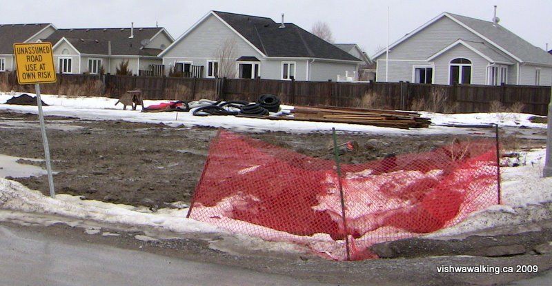
Mud and "unassumed roads" in Brighton's new suburban developments. February 12, 2009.
See the photos section for my rant on suburban development and the swallowing up of marshland.
Vishwawalking
Lake Ontario Waterfront
Trenton to Presqu'ile Park
Total: 13.8 kilometres Running Total: 22

12 O'clock Point to Lovett/Murray Canal: 6.2 km
Western extension of canal: 1.6 km x 2 (round trip)
This section runs along Murray Canal from 12 O'clock Point to Lovett (or the village of Murray Canal — it's Lovett on the map, Murray Canal on village signs) is a flat and easy walk, but very straight. You can walk on either side. The south side looks a bit more attractive, and there is the occasional vehicle on a short section of the northern side.
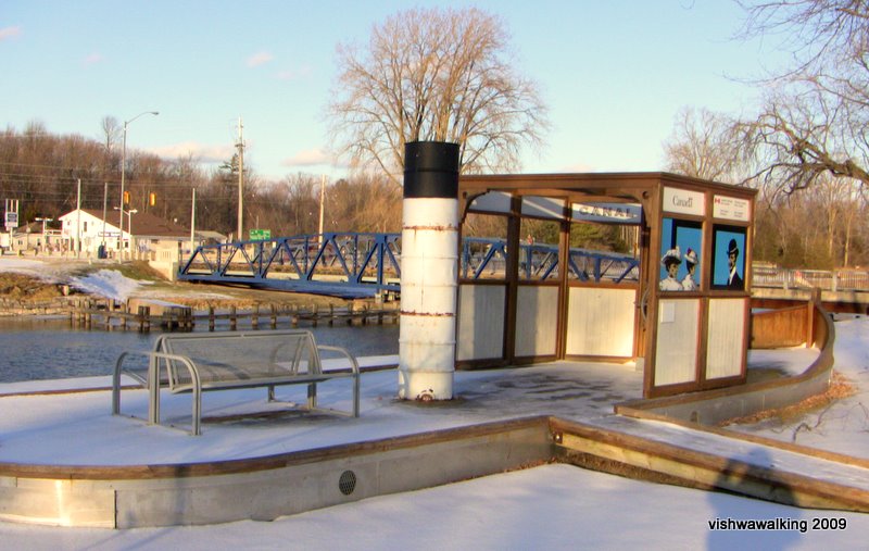 Shortly after leaving the
with the swing bridge in the background. (See the photo section for information boards
on the tugboat, which describe the history of the canal.) January 5, 2009
At the
Lovett end, there are cedars between
the trail and the canal. If there's a cold breeze blowing, they cut the wind nicely.
To the
north of the canal,
East,
across Brighton Road/64, I followed
the canal along the south trail. This is a side tour on the shoreline
walk, but
it seems essential to walk the length of the
The
Rating:
County Road #64 Lovett (Murray Canal) to Presqu'ile Park (13.2 km)
Until you
get to Gosport, this is a boring
section. There are pretty
ordinary houses along this paved road. Brighton Speedway
is situated on the
south side just over a kilometre out of
After
 Also
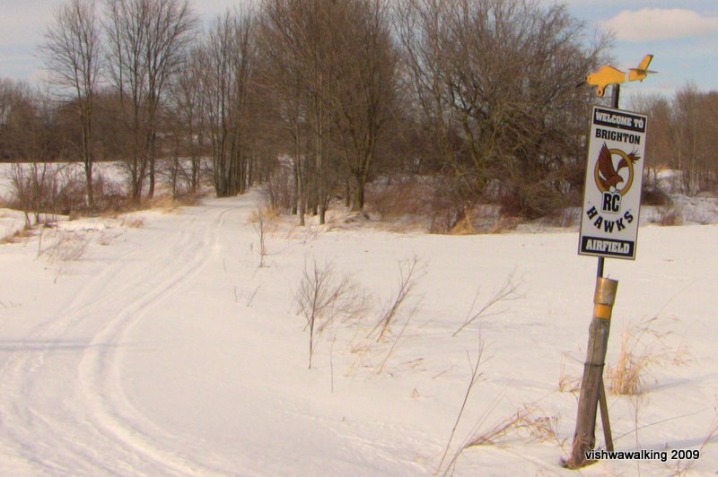
on the north side of County Road #64 is the property of the Brighton RC
Hawks, a radio-controlled model airplane flying club ("R/C" stands for
"radio control"). (See photo, left.)
Also
on the north side of County Road #64 is the property of the Brighton RC
Hawks, a radio-controlled model airplane flying club ("R/C" stands for
"radio control"). (See photo, left.)
A
“Constructed Wetland for Waste Water
Polishing” on County Road 64 just before the turn south into
The “polishing” (what a great euphemism!) is apparently effective, and the plant includes an aerated lagoon and a waste stabilization pond, both of which can be viewed on the north side of County Road #64. The constructed wetland was installed in 1999, but now the system needs a $6.4 million upgrade.
For birders, the constructed wetland has a number of treasures. Here’s a birder’s sightings from April, 2008 (unedited):
“A
Lesser Yellowlegs, 2 Dunlins, a Semi-palmated Sandpiper as well
numerous
Blue-Winged Teal, Buffleheads, Green-Winged Teal, a few Mallard,
Northern
Shovellers, Mute Swans including the mixed pair Trumpeter/Mute, the
Common
Moorhen seen as well as heard calling, a pair of Belted Kingfisher and
the pair
of Osprey (on their pole), White throated Sparrow and Song Sparrows,
Killdeer a
Double Crested Cormorant and Caspian Tern also did a very low fly-by.
“The regular visitors / summertime residents include Tree Swallow, Northern Rough winged Swallow, and a couple of Barn Swallows many Red-Winged Black birds and Common Grackle, Cardinals, Northern Flickers, Blue Jays and Canada Geese.”
Cars and
trucks travel at a good clip along
the road section. It’s really the only way I could see to continue
westward, but
otherwise it’s a waste of a walk. It’s part of the Lake Ontario
Waterfront
Trail and also part of the Port Hope to
 After
the turn left into Harbour St., it gets more interesting. In
the
winter, just past Butler
Creek,turn left again (on the opposite side from Butler Creek Trail)
and follow the snowmobile trail through the woods and out
into
the
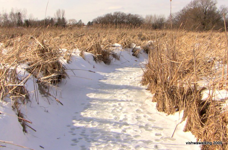
marsh. You'll see Butler Creek winding off to your left. When it
leaves the trees, have a look at it. If it's cold enough it makes a
fine walkway out to the lake. Follow it as
it twists its
way to the lake. It goes over a beaver dam at one point and you can
hear water gurgling; give that a bit of a skirt. You can then stay with
the trail on the lake as it goes around the point, or come off the lake
and follow any street westward to Bay Street and Baldwin.
After
the turn left into Harbour St., it gets more interesting. In
the
winter, just past Butler
Creek,turn left again (on the opposite side from Butler Creek Trail)
and follow the snowmobile trail through the woods and out
into
the
marsh. You'll see Butler Creek winding off to your left. When it
leaves the trees, have a look at it. If it's cold enough it makes a
fine walkway out to the lake. Follow it as
it twists its
way to the lake. It goes over a beaver dam at one point and you can
hear water gurgling; give that a bit of a skirt. You can then stay with
the trail on the lake as it goes around the point, or come off the lake
and follow any street westward to Bay Street and Baldwin.
Butler Creek makes a nice trail through the
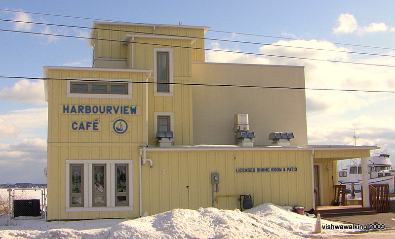
In the summer, I'm afraid the boring walk continues. Once on Harbour Street and over the Butler Creek bridge, turn left (south) at Baldwin. Follow that to Bay Street and the Harbourview Café where you can have a cup of tea and a snack. In winter it's open from 8 a.m,. to 8 p.m., except on Tuesday's when it's closed.
The
Harbourview Café in Gosport is a fine (and warm) end to a winter walk.
January, 2009
Gosport is worth a little tour. In winter you can visit the fishing "village" just off the shore. Take a walk along Bay, then cut up to the right on Lambton Street. if you take a short tour down one of the dead-end streets to your left, you'll get views of Presqu'ile Bay and Presqu'ile Point. There's some new building going on here — more private dwellings hogging what should be public waterfront.
At the top of Lambton Street turn right and head up Baldwin and back to Harbour Street. Turn right back to the Butler Creek bridge and head down the Butler Creek Trail.
|
Butler Creek makes a nice trail
through the |
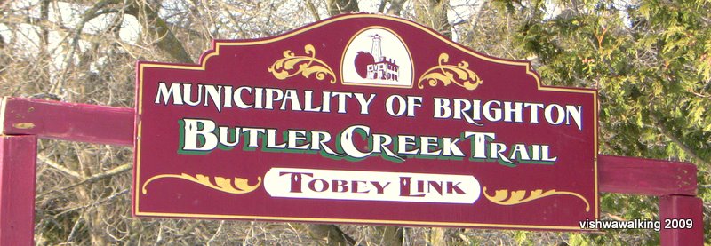
This
section of Butler Creek Trail is just short of .7 km. In 2003, the Canada-Ontario Infrastructure Program (a coalition of federal and provincial funding) talked about a 4.5 km trail they were supporting financially. At present, the "Tobey" is the only section constructed. It passes perilously close to some unfinished suburban houses in the Mill Pond Woods being constructed by Gordon Tobey Developments Ltd., presumably the Tobey the trail link is named after. The trail is squeezed between suburban developments; despite this it's a good short walk and a welcome relief from the boredom of County road #64. At Cedar Street, you will need to turn left (south). However, a quick walk into Brighton is worth it, to check out some of the historical bits, antique shops, restaurants and the like. Rating: |
When you arrive at Cedar Street, turn left and walk just short of .8 km to Harbour Street, where you will turn right (west). Before that, head out to the "Observation Point" at the end of Cedar. Just before the water's edge, you feel like you're walking on someone's private grass, but the sign indicates it's public property. In winter, you can go onto the ice to get a good view of the shore. It's not pretty. Ugly oversize houses have shut the shoreline off from public use. It's a too- real example of pathetic urban planning. The walk to the entrance of Presqu'ile Park is pretty boring, so you can amuse yourself by wandering some of these desolate suburbs; they're an exercise in lack of imagination. See my mini-photo essay about this in the photos section.
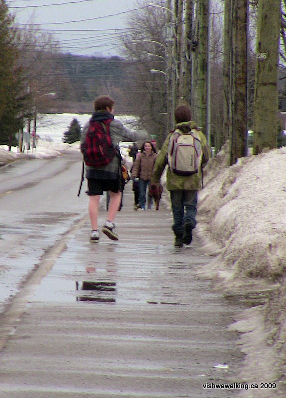
February 12, 2009. The temperature was around
freezing, with a cold breeze making things feel colder.
Shorts weather for sure! February 12, 2009.
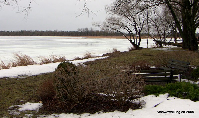
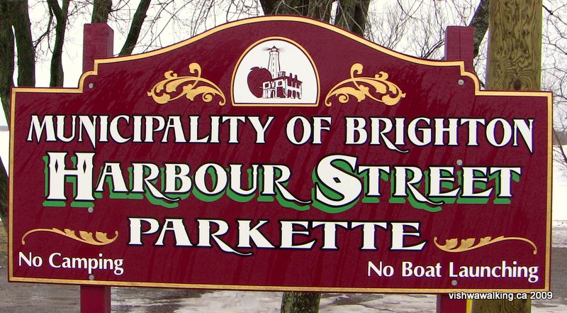
Harbour Street. This little park is all that's on offer for the public.
After getting back to Harbour Street, follow that (with deviations noted above) all the way to the Presqu'ile Park gates. Older houses along Harbour street block the shore from you. There is only one tiny park before Ontario Street left for public use. Pathetic.
Ratings: County road #64
section:  ;
Gosport:
;
Gosport:
Marsh
section (winter) into Gosport::
Updated: February 12, 2009