About Us
Vishwawalking explained
 Ratings Explained
Vishwawalks
Day walks
Funky Places
Future walks
Food
Gear
Get Lost
Good reads
Links
Right to Ramble
Site map
Contact us
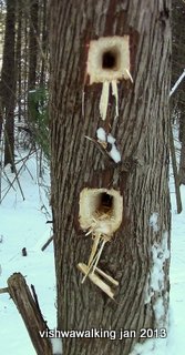
Along the Heritage Trail: huge pileated woodpecker holes. Watch out for a number of these on the trails.
Vishwawalking
O'Hara Mill Homestead and Conservation AreaAddress:
638 Mill Road (P.O. Box 56)
Madoc, Ontario K0K 2K0
 How to get there:
The area is north of Highway #7 and west of Madoc.
From Madoc it's 6 kilometres to O'Hara Mill. From downtown Madoc drive a kilometre to Highways #7 and #62. Continue north from there another 1.7 kilometres to to Mill Road (Riggs Road will be on your right). Turn left (west) on Mill Road and travel another 3.2 kilometres to the gate of the park. You'll cross O'Hara Road and Johnson Road on this leg.
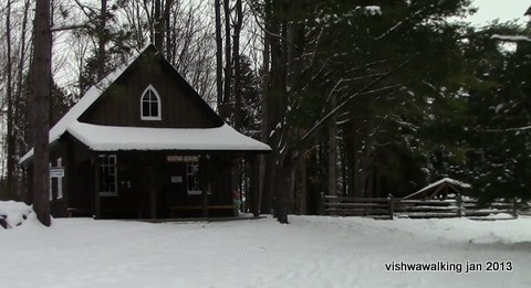
The Visitor Centre. Most of the trails can be accessed just to the right of the centre.
This conservation area has some fine walks, all near O'Hara Pond and the recreated homestead. Several years ago, the area offered only a short walk. Since 2011 a number of trails have been created. There are now roughly 5.5 kilometres of trails here, and eight or nine differently-named trails. You can do them all in an afternoon. The trails are colour-coded and constantly criss-cross. Without a map it is confusing. However, trails are short so you would have to work hard to get lost.
When I walked the park in January 2013, there were no skiers and few walkers, despite perfect snow conditions. The trails seemed underused.
In winter, the gates to the area are closed, so you must park your car on Mill Road by the gates. In summer, when the gates are open, you can park in the lot about 100 metres from the road, near the pond.
In winter, there is a tobagganing hill near the pond, which gets a good bit of use if the snow cooperates. In 2013, part of the pond was cleared for skating. Overall, a great family place.
Geocaching: there are, apparently six geocaches in the conservation area according to information on the the "friends" site (see link below).
Check out the map at the parking lot to get your bearings, then walk another 165 metres along the edge of the pond to the bridge. You can walk over the bridge and head right into the little meadow where you can have a look at the mini pioneer village. If you go to the top of the hill, you can pick up a hiking trail map at the visitor centre; there's a box with pamphlets available if the centre is closed.
Walk to the left of the centre and you will find the start of the Lois Wishert Way, which manages to cross or intersect almost every trail in the park. If you've walked across the bridge and are at the Visitor Centre, take this route. However, a nice start to any walk is to the right of the lower bridge (before you cross it). This is Fern Trail.
Here's a list of all the trails:
Creekside
Deer Creek
Fern Trail (blue)
Heritage Trail (yellow)
Homestead Pathway (pink)
Louis Wishart Way (red)
McEathron Trail (green)
Purple Loop (purple)
Wagon road (black)
Woodland Trail (white)
Homestead Pathway
165 metres
This little pathway takes you from the parking lot to the mill bridges. You can get to the bridges by taking the 140 metre shortcut off to the right just inside the gates and through the wood fence to the bridges, thus missing the pathway. However, it's more fun to walk the 100 metres to the parking lot and then veer right to the pathway.
Rating: very pleasant, but too short to be rated as a walk in itself. Very easy.
Fern Trail
220 metres Blue markers
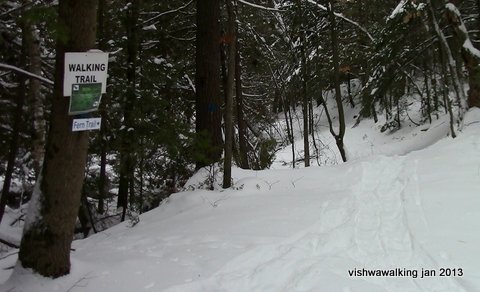 This short trail, starts at the lower mill bridge. It initially runs beside Deer Creek and ends
at the back road to the buildings.
This short trail, starts at the lower mill bridge. It initially runs beside Deer Creek and ends
at the back road to the buildings.You can then take an easy and open walk walk over the bridge, into the meadow and up to the visitor centre (another 160 metres) to get to the other trails, or loop back through the meadow and over the bridge for a short walk back to the start of this trail.
A top-notch little stroll!
The start of the Fern Trail, just to the left of the lower bridge.
Rating: Too short to rate. This is a great stretch if you're nearby and have very limited time or if you just want to get away from some activity at the Homestead. It's also the best way way to start a longer walk on other trails. Easy.
Lois Wishart Way
1.2 kilometres Red markers
This is an "interpretive" trail — meaning that there are signs along the way pointing out the various kinds of trees. Many of the trails intersect with this trail, so it's the best one to try first to get your bearings.
 Start at either end. If you start in the parking lot, walk up the hill just beyond the pond and turn right.
 I started to the left of the Visitor centre and made a left at the clearly marked "T" intersection, where the Heritage Trail goes off to the right.
There are two creek crossings on this trail. The first, roughly 290 metres from the start, is very easy with strategically placed stepping stones. I would guess that it is crossable (with proper footware) even in high water times.
About 440 metres along the way, the trail crosses Deer Creek, over a fine wooden bridge built by high school students in 2018.
The trail then winds through the woods and around the mill pond. In the winter there is lots of toboggan/sleigh activity at this point: kids on the hill with endless energy accompanied by parents who had burned out some time ago and were now shivering by the picnic tables. You can cut the walk short here and head back to the parking lot, or do the final loop out almost to Mill Road and back to the parking lot. As you near the road, male a sharp left before the marshy bit (there are no markers her) and catch the trail through the cedars to the parking lot. The last bit is not too inspiring, so you won't lose to much if you give it a pass.
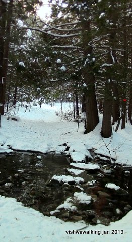
The first creek crossing for the Lois Wishart Way.
It's pretty easy.
Rating:


 Easy-moderate (Two creek crossings; a few hills.)
Heritage Trail
685 metres, not counting shortcuts, plus few metres more to get to it from the back of the buildings. Yellow markers.
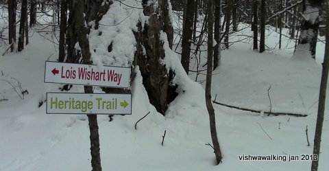 This
is a fine trail with some good ups and downs and some choices if you
want to shorten the walk by taking the shortcuts — or to lengthen it by
leaving it at the Woodland Trail (white markers) in the northeast corner of the park. If you do this you have lots of
options. One might be to take the outermost trails in the park: From
the Louis Wishart at the Visitor Centre to the Heritage Trail to the
Woodland Trail to the McEachern Trail (go right), to loop back to the
L. Wishart Way. Go right to get back to the parking lot. Presto! A fine
loop with no backtracking.
This
is a fine trail with some good ups and downs and some choices if you
want to shorten the walk by taking the shortcuts — or to lengthen it by
leaving it at the Woodland Trail (white markers) in the northeast corner of the park. If you do this you have lots of
options. One might be to take the outermost trails in the park: From
the Louis Wishart at the Visitor Centre to the Heritage Trail to the
Woodland Trail to the McEachern Trail (go right), to loop back to the
L. Wishart Way. Go right to get back to the parking lot. Presto! A fine
loop with no backtracking.The start of the Heritage Trail, not far back from the Visitor Centre.
The Heritage Trail can be confusing as the the number shortcuts can throw you. Basically, shortly after the start, avoid the first left, but be on the lookout for the second left. If you miss it, no worries, just curve back and you'll find the main trail. If you don't curve back and follow the stone fence, it will take you out to Johnson Road.
Rating:


 Easy-moderate. (A few hills.)
 Woodland Trail
550 metres Lime green markers
This is a great walk with varied trees: lots of coniferous trees, but some fine old hardwoods, sometimes in what seems like "streaks" amid the softwood.
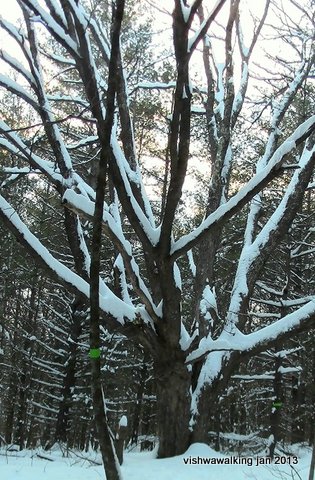
 A big old tree on the Woodland Trail.
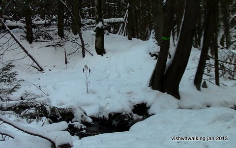
There's one tiny creek crossing near the start of the Woodland Trail that should not pose a problem.
Again, like most of the trails, the best option for the Woodland Trail is to mix and match to make a loop trail of a comfortable length.
Rating:


 Easy. (There's a little creek at the start that needs crossing.)
Creekside Trail
510 metres Orange markers
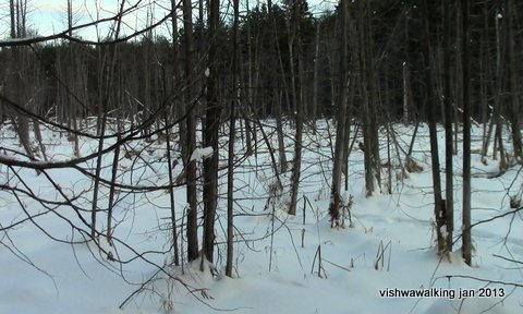 A
fun trail that runs mostly beside a big swamp full of dead trees. To
travel it from the start, cross the covered bridge and bear left
along the shore of the pond. At the end of the pond, you'll meet the L.
Wishart trail. Bear left here to cross the creek (you can see a picture
of the crossing in my L. Wishart Way description), then right again to
follow the edge of the marsh. The trail meets with the Woodland Trail,
so agian you can figure out a loop that suits you.
A
fun trail that runs mostly beside a big swamp full of dead trees. To
travel it from the start, cross the covered bridge and bear left
along the shore of the pond. At the end of the pond, you'll meet the L.
Wishart trail. Bear left here to cross the creek (you can see a picture
of the crossing in my L. Wishart Way description), then right again to
follow the edge of the marsh. The trail meets with the Woodland Trail,
so agian you can figure out a loop that suits you.Rating:


 Easy.
Easy. The Creekside Trail mostly follows a marshy area
McEathron Trail
915 metres Dark green markers (I am not sure how Quinte conservation counts this trail, unless they add shortcuts and/or the trails you need to walk to get to it. They list it as 1.75 kilometres. However, as far as the trial itself is concerned, that's overstating it.
This is the area's longest trail. I describe it from it's eastern point, right off the L. Wishart Way, going northward then curving west and returning southward to reconnect with the L. Wishart Way. There are a few "shortcuts that can turn you around if you're not careful. Check the map!
At about the 540 metre point, it crosses Deer Creek at what the volunteer's trail map describes as a "stone bridge." The bridge is long gone, so the crossing might be precarious for some.
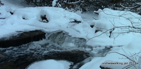 My picture on the left shows
it in the winter in 2013. When I travelled it in the spring of 2021, I
did not want to chance it as there was a lot of water. Just follow
Deer Creek Trail down to the bridge at Louis Wishart Way. You don't lose
much and you can still head up the McEathron trail on the west side of
the creek to safely check out the crossing from the other side..
My picture on the left shows
it in the winter in 2013. When I travelled it in the spring of 2021, I
did not want to chance it as there was a lot of water. Just follow
Deer Creek Trail down to the bridge at Louis Wishart Way. You don't lose
much and you can still head up the McEathron trail on the west side of
the creek to safely check out the crossing from the other side..The stone bridge crossing Deer Creek at the 540 metre point in the McEathron
Trail. The water at the bridge point is shallow, but step carefully, especially with
crusts of ice in the winter offering false support.
The creek is a really pretty area. Even if you do decide to wade the creek at the upper McEachern "bridge," step down the Deer creek Trail a (to the left/south) a bit and marvel at the water coursing under the trees.
When you're over the creek, reconnect with the Louis Wishart Way, turn right and head up the hill and around the pond to get back to the parking lot.
Rating:


 Easy-moderate (One creek crossing.)
Deer Creek Trail
535 metres White markers
A beautiful little stretch of trail along the creek. I describe it from north to south.
The creek is sometimes a meandering brook and sometimes a larger marshy expanse. At one point you'll cross the Louis Wishart Way. You can head right over the creek here if you want and then curve around the pond on the L. Wishart Way back to the parking lot. Stick to the trail and you'll walk out onto the northern point of the pond.
As you get to the pond, walk out to the little point and then loop back across the trail and head eastward to connect with the Creekside Trail. There's a little bridge just before the Creekside Trail; I'm not sure what is underfoot in summer in the marshy bit, but it was very solid in January.
By the way, the map shows that this trail reconnects with the L. Wishart Way. Perhaps there is a summer trail that curves a bit more northward, but the winter trail (across the little bridge) links with the Creekside Trail that can then take you back to the main covered bridge.
Rating:


 Easy
EasyPurple Loop
435 metres Purple markers
This is a gentle walk, mostly through hardwood. It curves weastward then northward to the edge of the O'Hara property from the Louis Wishart Way and McEachern Trail junction south of the bridge and ends in the upper northwest corner of the property. You can then loop back over the latter part of the McEachern trail (or head over the creek "bridge" if it is passable and continue east on the McEachern Trail).
Rating:


 Easy
Easy.
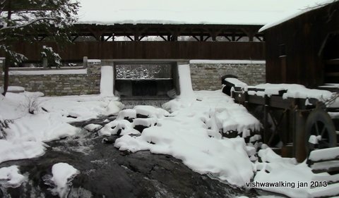
The upper covered bridge. Cross this bridge and you'll be in the mini pioneer-
village. There's also a little uncovered bridge at about the point this picture was
taken. January, 2013
Links:
O'Hara Mill and Conservation Area
(This is the volunteer organization that keeps the mill and its trails running. Drop a couple of loonies in the boxes placed around the area to help them out. As noted in the trail descriptions, they have a lot of maintenance to keep trails and buildings in shape, and it's not cheap.)
2 Old Guys Walking have a great history of the nearby town (Madoc) and of the O'Hara family and their mill. They don't have trail descriptions but their history lesson is worth reading.
Home | Contact Us | Site Map
Page
created: Jan 3, 2013
Last walked: April 8, 2021
Last walked: April 8, 2021