About Us
Vishwawalking explained
 Ratings Explained
Vishwawalks
Parks, etc.
Funky Places
Future walks
Food
Gear and Health
Get Lost
Good reads
Links
Plants - Animals
Right to Ramble
Site map
Contact us
Vishwawalking
Lennox and Addington Forest Trails
The Pines
Flinton, Ontario
Map of The Pines These
trails are tailored for mountain bikes. There are just under 7
kilometres of trails interweaving with each other. Most of them are
short, but there are lots of them packed together. You can weave in and
out and spend time here doing different loops. All trails can be walked
in an afternoon.
These
trails are tailored for mountain bikes. There are just under 7
kilometres of trails interweaving with each other. Most of them are
short, but there are lots of them packed together. You can weave in and
out and spend time here doing different loops. All trails can be walked
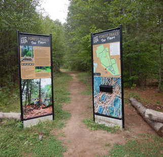
in an afternoon.The terrain is quite flat. The trails weave within tall pines, planted, but not in rows. The forest is very open. The earth is generally sandy. All trails are easy and this would be a fine walk for a family or for dog walkers. For bikers used to the crazy thrills of (say) the Millbrook trails, it might be a bit tame—but then again bikers have a habit of finding the dangerous bits, so maybe they're hidden from my walking eyes.
The entrance to The Pines trails is obvious just beyond the
large parking lot/ It is an extension of John Street. See "How
to get there," below Photo, September 3, 2021
No bikes were about when I walked these trails. I found the walks tranquil and pleasant. I could even trot on some of the straight sections, so runners might like it too.
Pines Loop Green markers 2 kilometres
This trail encircles the main part of the property. It's a flat and easy walk. Notice the berms at the corners farther from the entrance. It's a very rough square with a couple of corners cut off. The southern side of the square is very straight. Outside the park, just east of where the Southern Dip trail and this trail meet, there is a hunt stand and beyond that an open field where what looks like a hunt camp is located.
Cut-Through Red Markers 655 metres
This trail runs in a (roughly) east-west direction relatively close to the southern east-west side of the Pines Loop. It runs through mostly the pines, but includes a section of hardwood.
Up and Down Yellow markers 570 metres
With the Cut Through Trail, the Up and Down forms a lopsided cross within the Pines Loop. Nice flat walk through the pines a bit, with some hardwood. The trail weave about a bit and shares a short section with the Cut Through where they meet, a point appropriately called Crisscross Junction.
Church Pass Light Blue markers 290 metres
If you want to cut off the northern corner of the Pines Loop, take this trail. It's short and relatively straight. It curves slightly northward near the north end, but (travelling east) you can also continue straight on what is the continuation of the old lane the trail initially follows. Some maps show this path continuing out of the park onto private land and to Concession 5 South. I stayed withing the park.
Hardcase Brown markers 720 metres
According to the official literature, "a mysterious wooden container" was dug up during construction. No further details are given. The trail is also listed as medium difficulty in literature, but like most trails here it's an easy walk and I imagine pretty easy for bikes too. There's a confusing point just before the trail crosses the Up and Down Trail called the Lost and Found Loop. It seems to be simply a vague loop not clearly marked. The Hardcase Trail crosses the Up and Down Trail at the Cursive X intersection.
Lost Loop (and Found) unmarked 290 metres
See Hardcase above. Confusing. However, there are a couple of rock outcrops here that might excite bikers, who could manage some jumps here.
Southern Dip Purple markers 530 metres
A square loop if you include the Pines Loop part this trail abuts, which would make a roughly 700 metre loop.
A nice extension if you want to go beyond the Pines Loop. The north-south section of this square continues south onto private property. There are clear signs warning you to stop. Maps indicate some interesting lanes on private land spreading out east and west. Just beyond the park, the private trail opens onto some very sandy terrain (a beach but no water!).
Enchantment Light grey markers 385 metres
Another rough square that makes a loop if you include part of Dipsy Doodle and Southern Dip. There's a sign on the southern side that announces Emerald City. The sign did make me stop and meditate on the open pine forest to my right.
 Dipsy Doodle Dark Blue markers 1.2 kilometres
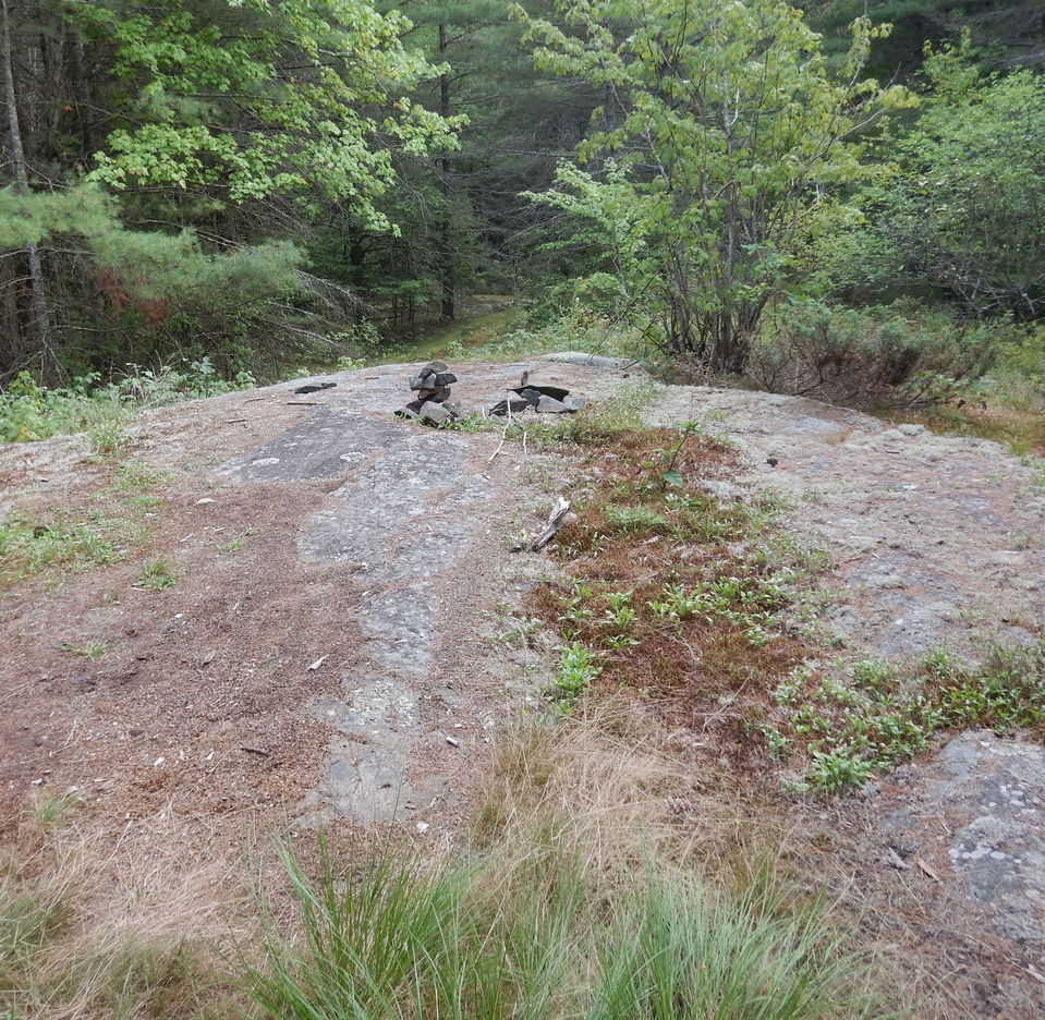
 This section is almost separate from the main trails and I'd guess the most interesting for bikers. The 1.2 kilometres are packed into a small area, perhaps no big deal for a walker. After all you can see the other side of the rock and the trails that wind around it. But for a biker, Little Rock and Big Rock are two outcrops that perhaps have potential for jumps and the like. Don't get me wrong: this area has the most ups and downs, so if you're walking you should wander through this part for sure.
Right: Big Rock, on the Dipsy Doodle trail, could be fun for bikers—or a good lunch spot for walkers if bikers are not using it. Photo, September 3, 2021
Unnamed Trail Unmarked 150 metres
At the western end of the Dipsy Doodle Trail (where it almost reaches the Upper Flinton Road and turns back to make a sharp point) there is a trail under construction. Like the Dipsy Doodle, it makes use of rock outcrops and might interest bikers. It's also a nice walk. The construction is clear even though there are not yet any markers (as of Septemer, 2021).
How to get there:
From Highway #7, just east of where Highway #37 joins it, County Road #29 (Flinton Road) heads northward up a hill. Follow it 17.5 kilometres to Flinton. At the T intersection just south of Flinton, turn right into town (i,e., stay on Flinton Road). You will very shortly see John Street and signs pointng you to the trails. Turn right here and into the parking lot. The trail entrance is very clear—it's just an extension of John Street.
Walkdude rating:


 .
.Page
created: September 7, 2021